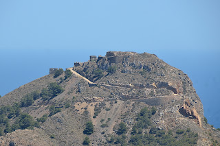
Several of us took a ride out to Cabo Tiñoso on Sunday afternoon. Cabo Tiñoso is a mountainuous peninsula between Mazarron and Cartagena.
The view is from the top of the mountain looking toward Mazarron.
Click on the map below for a larger view.
View Larger Map

There are a series of relatively new fortifications on the cape. These were built to defend the port of Cartagena which is a major Spanish Navy base.
The section shown here is an antiaircraft site.
We drove up to the top of the fort. It isn't for the faint of heart. Shear drops and just a few rocks to mark the side of the road here.
Here is another view from a different vantage point. I think this is from the communications antenna site. More on that later.

This the entrance to one of the main sections of the fort. This place was built between 1926 and 1933. It uses an interesting construction technique. The portions facing the sea are sort of camouflaged with a natural rock look.

This website describes the rest of the facility as Disneyesque. Cabo Tiñoso
These two pictures are of the Castillitos Battery. I think this is the stores building.

There is nothing Disneyesque bout these guns. They are 341mm or 13 inch guns and can shoot a shell 20 miles.
That is a fire control post in the background.

Here is a picture of Jia Wei standing next to one of the guns to give a little better perspective.
These things are 17 meters or roughly 55 ft long.
Here is one of the guns in the context of protecting the harbor.
According to the website above these guns were fired in anger only once in 1937. I saw another reference to them being fired on April 26th 1973 by Republicans at a group of Nationalist cruisers.

This is the Jorel battery. It had 3 smaller guns for shelling closer-in shipping. We didn't walk down to this one. It was a pretty good hike.
The fort was abandoned in 1994.

Here is a view of Cartagena Bay. There were a number of ships at anchor. The harbor at Cartagena is at the far end of the bay.
There is a matching set of guns on the other side of Cartagena harbor.
Here is a view of the harbor at La Azohia. The dock there was built to unload the cannons.
Greg, notice the beach scene on the right hand side of the picture.
Click to enlarge.
This is the communication tower on the west end of the cape. I have no idea how much radiation I was exposed to getting this picture.
Notice the observation post in the background.

This is a view of the valley at the north end of the cape. This area is known as Campillo de Adentro.
There is one restaurant in the little town there but otherwise the place is devoid of any services.

I think this was a barracks for the fort. It is located in the valley some distance from the fortifications.

This is about the only wildlife I've seen in Spain other than birds.
It looks a little mangy, though. Maybe it is still losing it's winter coat?

And finally, this is about the only bright color we saw on the day. It is all pretty brown or the green of scrawny pine trees and cactus.


Thanks Tom! Spain is not quite like I imagined. This is certainly a cheap and convenient way to tour the country.
ReplyDeleteUncle Chip
I'm glad I got to travel through your pictures. Hurry home!
ReplyDelete