Thursday, June 25, 2009


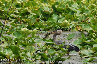
Doesn't this look like a picture from Florida? This is a cypress swamp in Kentucky. Map below. Click to enlarge.


Dragonfly. These pictures are from the Henderson-Sloughs Wildlife Management Area - Jenny Hole Unit. Took a drive out there on Father's Day.


Are these Black-Eyed Susans?


Please vote on which picture you like best. This one or the one below. You can vote by clicking the comment button.


Here is the second. Is this the same species that I posted last week?


This is a pretty good sized deer. He or she was a long way away.


Zoom out on the map below and observe how the Ohio River has sculpted the land over the ages.


View Larger Map

Sunday, June 21, 2009

Patoka River NWR Again


While Margot volunteered at the Evansville Children's Museum function this morning I took a drive back out to the Patoka River NWR. I thought this vine covered bridge over the channelized river was interesting.


Anybody know what these flowers are?


How about these? Margot thinks they are some sort of trumpet vine.


I thought the fungus was interesting


Anybody know what kind of bird this is? All I could come up with in the bird book is Savannah Sparrow.


Pretty sure this is a female Wood Duck. Mike?


Pretty sure this is an Indigo Bunting. Anybody know why they puff themselves up?


Here is a shot before he puffed up.

Monday, June 15, 2009

Patoka River Wildlife Management Area


I took a ride up to the Patoka River Wildlife Management area on Saturday. Didn't see a whole lot of wildlife. I did see this patch of what I think are blackberries along the river trail.


If you want to learn more check out the Auto Tour Narrative here.
http://www.fws.gov/midwest/patokariver/


The Patoka river is an example of water management gone bad. In the early 1900s the river was channelized. A barge was moved in a more or less straight line for 17 miles or so and a channel was cut to encourage better draining and to make the land more hospitable for farming. Some genius failed to realize that the spoil banks on either side would keep the water from seasonal floods from draining back into the river. So the project turned marginal agricultural land into swamps. Turns out that the slow draining of the original river course had more to do with the level on the Wabash river than anything.


Seems like Blue Herons are becoming a specialty. Happened across this one at the boat ramp in the google map link. Pretty big fish - some sort of sun fish - according to Wikipedia. Gulped it down whole and flew off. Click to enlarge.


View Larger Map

The heron picture is at the boat ramp in the center of the map. The turtles are near the fishing pier off to the east. Zoom out and go north to see the Patoka River channel.

Thursday, June 11, 2009

Sunset and Backyard


Just some pictures from around the backyard. These lilies survived the rabbit attack a couple of weeks ago. Several others weren't so lucky.


Today is the day to update this caption. Thanks Mom and Dad. This is a hydrangea bush. It looked very nice until last night. The inch + of rain must have made the flowers too heavy. It is all collapsed now. Anyway it was a big bush with lots of blooms.


This clematis is doing better now that it has a proper trellis to wind around.


This couple was snacking on thistle seed. I set the camera up outside near the kitchen windows. I focused it on the bird feeder and set to remote operation. I went inside and used the remote to trigger the shutter. The remote is a little infra-red device but it would not go through the window and solar film. I had to crack the window open to get it to operate.


These are actually in the front yard by the sidewalk to the front door.


This is the sunset Monday night. I took these about 8:10 PM so it should have been pretty dark. I can't figure out what the cloud formation was that would reflect this light back down. It was really dramatic.


A continuing view more to the northwest. The previous picture was more or less due west.


In case there were any doubters. The postings a few days ago about the eagles really are eagles. I went back on Sunday afternoon to see if there was any action in the nest. The two eaglets were bobbing around in the nest but made a pretty boring picture. This guy was hanging out nearby.

Monday, June 8, 2009

Hovey Lake and Howell Wetlands


Saturday was a pretty nice day here so Jacques, Margot and I took a drive out to the Hovey Lake wildlife management area in Indiana. If Indiana is shaped like a boot, this area is the big toe. See attached map. Actually we didn't see much wildlife.


We did spot this Red Headed Woodpecker.


We went down to the boat ramp at the end of the road. I thought this coal loading facility near Uniontown, Ky was interesting. It is at the end of a 10 to 15 mile long conveyor. You can follow the conveyor backwards on the map if you are really bored.


If Hovey Lake is the big toe, we took this picture on the road at the edge of the toenail. The road follows along the edge of what used to be a bend in the Wabash River. Now it is a wetlands/slough.


On the way back to town, we stopped by Howell Wetlands to show it to Margot and the dog. I've posted pictures from there before. Margot spotted these birds in the tree tops. We are pretty sure they are Cedar Waxwings.


Personally, I'm tired of Canada Goose pictures but Margot thought they were pretty cool. The new lens does take better pictures at these distances, too. So if you were always hoping for a better look at one of these, here you go.


I'm thinking this is the same Great Blue Heron I've posted before. I thought the setting was nice though.


After a few minutes he flew 30 yards over to this spot.


He walked around for a few minutes and then ...


POW! He speared this little fish.


Not sure exactly how he maneuvered it around, but in a minute he swallowed it whole.


Hovey Lake is to the east of Highway 69.


View Larger Map

Friday, June 5, 2009

Great Blue Herons and Bald Eagle


Do you find Great Blue Herons to be an interesting bird? If so, I've got a spot for you to visit. This is just across the Ohio River from Evansville. I'll put a google maps link below.


There are six or seven herons in this picture. I went to this spot because of a newspaper article reporting a bald eagle's nest here. I couldn't locate the eagles but you couldn't miss the herons.


It was a good excuse to try out Margot's new lens. It is a Sigma 120 to 400 zoom. Takes good pictures but it is really big and heavy. The wading birds must have been 700 ft away. The birds in the cypress trees were about 1000 ft away judging be the scale on the map.


How many can you count in the picture above? I got about 17. Click to enlarge. To the right is another group nearby. Must have been at least 100.


Went back to the slough on Friday afternoon to look for the eagles. Couldn't find them. Hung out and took some other pictures. It was a nicer day. Didn't see it until we got home and put the pictures on the screen. Take a look in the lower right hand corner.


Here is a Red-Winged Blackbird.


A turtle catching some rays.


We left and came back in the early evening about 7:00. The light was nicer and we took some more pictures. An older couple pulled up with their binoculars and lawn chairs. They pointed us to the eagle nest. We were looking in the right place but just couldn't pick it out.


However, the eagles weren't really cooperating. This is the best I could do.


View Larger Map

The pictures were taken looking north from about the "W" in Wolf Hills Rd.